Trail Walking Toblach - Dobbiaco - Silverstertal - Valle San Silvestro - Photo
© OpenStreetMap contributors
Length
Length
13 km
Max alt
Max alt
2115 m
Uphill gradient
Uphill gradient
627 m
Km-Effort
Km-Effort  
21 km
Min alt
Min alt
1495 m
Downhill gradient
Downhill gradient
626 m
Boucle
Boucle
Yes
Creation date :
2022-07-19 07:39:05.002
Updated on :
2022-07-25 11:23:47.278

(0 Reviews)

Walking
Walking
4h37
Difficulty : Medium

Scan this QR Code to open this trail in the SityTrail application

FREE GPS app for hiking

Logo SityTrail SityTrail

IGN / Geographical institutes

Download SityTrail from the App Store Download SityTrail from Google Play

Logo SityTrail SityTrail World

The world is yours!

Download SityTrail from the App Store Download SityTrail from Google Play Download SityTrail on Huawei AppGallery

About

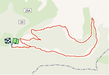
Trail Walking of 13 km to be discovered at Trentino-Alto Adige/Südtirol, South Tyrol, Toblach - Dobbiaco. This trail is proposed by VacheKiri67.

Description

Faite le 19/07/2022.
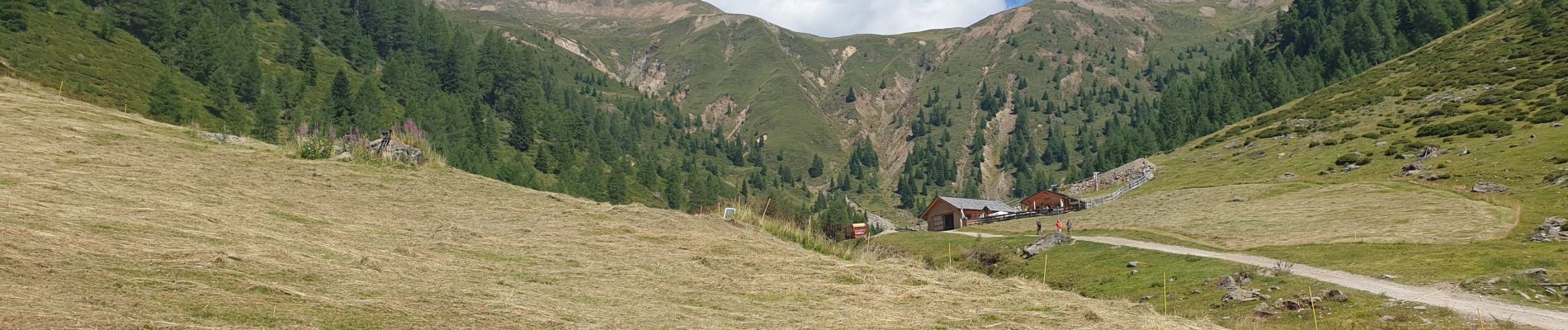
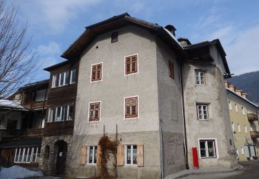
Parking Schönegger Säge 1495m.
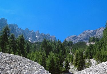
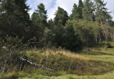
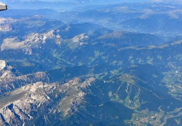
Balisage 1 jusqu'à Silvesteralm 1800m puis Steinbergalm 1926m. Montée par chemin balisé vers 2115m qui offrira un magnifique panorama sur les Dolomites. La descente est assez longue et raide.
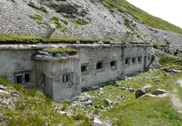
Pour les courageux, dont nous n'avons pas fait partie ce jour là compte tenu de la chaleur caniculaire, on peut ensuite monter à la Bonner Hütte 2340m. Compter 225m de dénivelé et 5km de plus (difficile).

Elevation profile

Photos

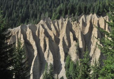
47 photos in total. Please click on a photo to see them all in the gallery.

Positioning

Country:
Italy
Region :
Trentino-Alto Adige/Südtirol
Department/Province :
South Tyrol
Municipality :
Toblach - Dobbiaco
Location:
Unknown
Start:(UTM)
290435 ; 5182005 (33T) N.

Trails nearby

Trail On foot Toblach - Dobbiaco - IT-25A - Photo
On foot
PRO

On foot

Easy
Toblach - Dobbiaco, Trentino-Alto Adige/Südtirol, South Tyrol, Italy
4.3 km | 7 km-effort
1h 35min
No
Trail On foot Innichen - San Candido - IT-6 - Photo
On foot
PRO

On foot

Easy
Innichen - San Candido, Trentino-Alto Adige/Südtirol, South Tyrol, Italy
4.3 km | 12.1 km-effort
2h 45min
No
Trail On foot Innichen - San Candido - IT-28 - Photo
On foot
PRO

On foot

Easy
Innichen - San Candido, Trentino-Alto Adige/Südtirol, South Tyrol, Italy
4.9 km | 9.8 km-effort
2h 13min
No
Trail On foot Toblach - Dobbiaco - IT-60 - Photo
On foot
PRO

On foot

Easy
Toblach - Dobbiaco, Trentino-Alto Adige/Südtirol, South Tyrol, Italy
7.7 km | 12.1 km-effort
2h 44min
No
Trail On foot Toblach - Dobbiaco - AT-25 - Photo
On foot
PRO

On foot

Easy
Toblach - Dobbiaco, Trentino-Alto Adige/Südtirol, South Tyrol, Italy
6.6 km | 19 km-effort
4h 18min
No
Trail On foot Toblach - Dobbiaco - Toblacher Höhenweg - Via Alta di Dobbiaco - Photo
On foot
PRO

On foot

Difficult
Toblach - Dobbiaco, Trentino-Alto Adige/Südtirol, South Tyrol, Italy
17.8 km | 34 km-effort
7h 46min
No
Trail On foot Innichen - San Candido - AVS 4 - Photo
On foot
PRO

On foot

Medium
Innichen - San Candido, Trentino-Alto Adige/Südtirol, South Tyrol, Italy
13 km | 26 km-effort
5h 47min
No
Trail On foot Toblach - Dobbiaco - IT-26 - Photo
On foot
PRO

On foot

Easy
Toblach - Dobbiaco, Trentino-Alto Adige/Südtirol, South Tyrol, Italy
5.9 km | 9.9 km-effort
2h 15min
No
Trail On foot Innichen - San Candido - IT-105 - Photo
On foot
PRO

On foot

Difficult
Innichen - San Candido, Trentino-Alto Adige/Südtirol, South Tyrol, Italy
19.7 km | 36 km-effort
8h 16min
No


Close
My subscriptions